
Commercial Drone Services for Minnesota Industries
SkyView Drone Services MN provides advanced drone technology solutions for businesses, government agencies, and organizations across Minnesota. Our FAA-certified drone pilots deliver high-resolution aerial imaging, LiDAR mapping, thermal inspections, and volumetric analysis to support industries that require accurate data, efficient inspections, and improved operational insights.
Drone technology allows organizations to collect detailed aerial data faster, safer, and more cost-effectively than traditional ground inspections or manned aircraft. From infrastructure inspections and land development planning to agricultural monitoring and emergency response, drone services are transforming how industries operate throughout Minnesota.
SkyView Drone Services MN supports a wide range of industries by providing reliable aerial data, professional reporting, and advanced drone technology solutions tailored to the unique needs of each sector.

Industries We Serve

🏗 Construction & Land Development
Monitor job sites, track progress, and generate accurate 3D models with drone mapping and aerial inspections.
✔ Site mapping & surveying
✔ Progress tracking
✔ Stockpile volume measurement
✔ Infrastructure inspections

⚡ Energy & Utility Infrastructure
Inspect powerlines, substations, and solar assets while detecting issues before failures occur.
✔ Thermal inspections
✔ Solar panel analysis
✔ Powerline monitoring
✔ Substation inspections

🛣 Infrastructure & Transportation
Inspect bridges, highways, and transportation systems with safer, faster aerial data collection.
✔ Bridge inspections
✔ Roadway analysis
✔ Structural monitoring
✔ Planning support

🌲 Environmental Monitoring & Wildlife Conservation
Track environmental changes and monitor habitats with aerial data collection for conservation efforts.
✔ Habitat mapping
✔ Vegetation analysis
✔ Environmental monitoring
✔ Wildlife tracking

🚨 Public Safety & Emergency Response
Support emergency teams with thermal drones and real-time aerial awareness for faster response.
✔ Lost pet recovery
✔ Thermal search
✔ Search & rescue
✔ Disaster response
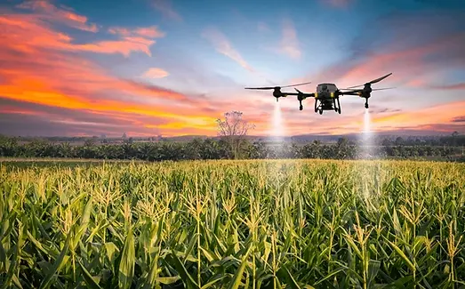

🌾 Agriculture & Precision Farming
Monitor crop health and identify irrigation or pest issues early using aerial imaging and data.
✔ Crop health analysis
✔ Irrigation monitoring
✔ Field mapping
✔ Thermal crop scans

🏡 Real Estate & Property Marketing
Showcase properties with high-quality aerial photography and video from unique perspectives.
✔ Listing photography
✔ Aerial video
✔ Property mapping
✔ Commercial marketing