The Future of Land Surveying with Aerial Technology
- Codi Dittrich
- Sep 29, 2025
- 3 min read

Land surveying has traditionally been a time-consuming and labor-intensive process. However, the integration of aerial technology, especially drones, is revolutionizing the field. This transformation is making surveying faster, more accurate, and cost-effective. In this article, we will explore how drone surveying is shaping the future of land surveying, the benefits it offers, and practical insights into its implementation.
The Rise of Drone Surveying in Land Measurement
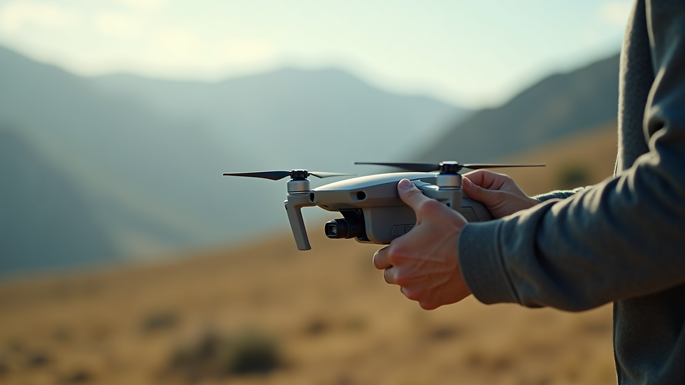
Drones equipped with advanced sensors and cameras are now widely used in land surveying. These unmanned aerial vehicles (UAVs) can capture high-resolution images and generate detailed maps and 3D models of terrain. Unlike traditional methods that require physical presence on-site, drones can cover large areas quickly and safely.
For example, construction companies use drones to survey building sites before starting work. This helps identify potential issues early and plan more efficiently. Environmental agencies also rely on drones to monitor changes in landscapes, such as erosion or deforestation, without disturbing the area.
The technology behind drone surveying includes GPS, LiDAR, and photogrammetry. These tools allow for precise measurements and data collection, which can be processed into actionable insights. The ability to gather data from hard-to-reach or hazardous locations is a significant advantage.

Advantages of Drone Surveying for Modern Projects
Drone surveying offers numerous benefits compared to traditional land surveying methods. Here are some key advantages:
Speed and Efficiency: Drones can survey large areas in a fraction of the time it takes for ground crews.
Cost Savings: Reduced labor and equipment needs lower overall project costs.
Safety: Drones eliminate the need for surveyors to enter dangerous or inaccessible areas.
Accuracy: High-resolution sensors provide detailed and precise data.
Versatility: Suitable for various industries including agriculture, mining, construction, and environmental monitoring.
For instance, in agriculture, drones help farmers monitor crop health and soil conditions, enabling targeted interventions that improve yield. In mining, drones map out excavation sites to optimize resource extraction and ensure safety compliance.
If you want to explore professional options, consider surveying with drones services that specialize in aerial data collection and mapping.

How much does drone surveying cost?
Understanding the cost of drone surveying is essential for budgeting and project planning. The price varies depending on several factors:
Project Size: Larger areas require more flight time and data processing.
Data Complexity: Advanced mapping techniques like LiDAR increase costs.
Frequency: Regular surveys for ongoing projects add to expenses.
Equipment and Software: High-end drones and specialized software can be costly.
Operator Expertise: Certified and experienced drone pilots may charge higher fees.
On average, drone surveying can cost between $200 and $1,500 per day, depending on the scope and requirements. For smaller projects, prices might be lower, while complex industrial surveys could be more expensive.
Investing in drone surveying often results in long-term savings by reducing errors, speeding up project timelines, and improving decision-making accuracy. It is advisable to request detailed quotes from service providers and compare their offerings.
Practical Tips for Implementing Drone Surveying
To maximize the benefits of drone surveying, consider the following recommendations:
Choose the Right Drone: Select drones with appropriate sensors and flight capabilities for your project needs.
Understand Regulations: Comply with local aviation laws and obtain necessary permits.
Train Operators: Ensure pilots are certified and knowledgeable about safety protocols.
Plan Flights Carefully: Optimize flight paths to cover the area efficiently and capture quality data.
Use Reliable Software: Invest in software that can process and analyze aerial data accurately.
Integrate with Existing Systems: Combine drone data with GIS and CAD tools for comprehensive analysis.
For example, a construction firm might schedule weekly drone flights to monitor progress and update site maps. This allows project managers to track changes and address issues promptly.
Emerging Trends in Aerial Surveying Technology
The future of land surveying with drones is bright, with continuous advancements enhancing capabilities:
Artificial Intelligence (AI): AI algorithms are improving data analysis, enabling automatic feature recognition and anomaly detection.
Swarm Drones: Multiple drones working together can cover vast areas faster and with greater detail.
Improved Battery Life: Longer flight times increase efficiency and reduce downtime.
Integration with IoT: Real-time data sharing with other devices enhances monitoring and decision-making.
Enhanced Sensors: New sensor technologies provide better resolution and multi-spectral imaging for diverse applications.
These innovations will further reduce costs and expand the range of applications for drone surveying. Businesses that adopt these technologies early will gain a competitive edge.
Embracing drone surveying technology is no longer optional but essential for modern land surveying. It offers unmatched speed, accuracy, and safety, transforming how projects are planned and executed. By understanding the costs, benefits, and best practices, organizations can leverage aerial technology to achieve better outcomes and stay ahead in their industries.


Comments