Unlocking the Power of Drone Data Analysis in Minnesota
- Codi Dittrich
- Jan 8
- 3 min read

Updated: Mar 16
Why Aerial Data Matters More Than Ever in Minnesota
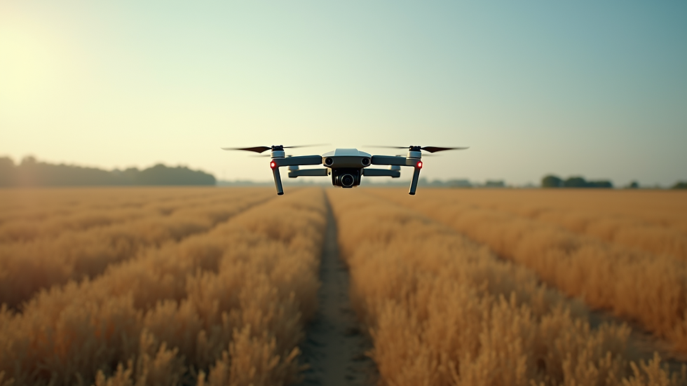
Minnesota’s diverse landscapes—from dense forests to sprawling urban areas—pose unique challenges and opportunities. Traditional data collection methods can be slow, costly, and sometimes dangerous. Drones offer a fresh perspective, literally, by capturing high-resolution images, thermal scans, and 3D maps quickly and safely.
For example, public safety agencies can use drones to assess disaster zones without putting personnel at risk. Businesses can monitor construction sites or agricultural fields with precision. Pet owners benefit from thermal imaging to locate lost animals in vast or wooded areas. The ability to gather detailed aerial data fast is a game-changer.

The Benefits of Drone Data Analysis
Collecting data is just the first step. The real value lies in analyzing that data to make informed decisions. This is where drone data analysis comes into play. By processing images, videos, and sensor readings, you can identify patterns, detect anomalies, and predict outcomes.
Here’s how you can leverage this:
Precision Mapping: Create detailed maps for construction, agriculture, or environmental monitoring. These maps help track progress, spot issues early, and plan efficiently.
Thermal Imaging: Detect heat signatures to find lost pets or identify equipment overheating in industrial settings.
3D Modeling: Build accurate 3D models of terrain or structures for better visualization and planning.
Change Detection: Compare data over time to monitor changes in land use, vegetation health, or infrastructure conditions.
The key is to use software tools that simplify data processing and visualization. Many platforms offer user-friendly dashboards that turn complex data into clear, actionable reports.
How SkyView Drone Services MN Elevates Your Data Experience
At SkyView Drone Services MN, we understand that speed and accuracy are critical. Our team specializes in rapid deployment and precise data capture tailored to Minnesota’s unique environment. Whether it’s a sprawling farm, a busy construction site, or a search operation in the woods, we deliver reliable aerial data solutions.
We also offer specialized services like thermal pet recovery, which has helped many pet owners reunite with their furry friends faster than ever before. Our commitment is to provide not just data, but insights that empower you to act confidently and quickly.
Practical Tips to Maximize Your Drone Data Use
If you’re new to drone data or looking to improve your current approach, here are some practical tips:
Define Your Goals Clearly: Know what you want to achieve before flying. Are you mapping, inspecting, or searching? Clear goals guide data collection and analysis.
Choose the Right Drone and Sensors: Different tasks require different equipment. Thermal cameras for heat detection, multispectral sensors for agriculture, or high-res cameras for mapping.
Plan Your Flight Paths: Efficient flight planning ensures complete coverage and optimal data quality.
Use Reliable Data Processing Tools: Invest in software that can handle your data type and volume, offering easy-to-understand outputs.
Train Your Team: Understanding how to interpret drone data is as important as collecting it. Training helps you make the most of your investment.
Stay Compliant: Follow FAA regulations and local laws to ensure safe and legal drone operations.
The Future of Aerial Data in Minnesota’s Industries
The potential for drone data analysis in Minnesota is vast and growing. From precision agriculture that boosts crop yields to infrastructure inspections that prevent costly failures, drones are becoming indispensable tools. Public safety agencies are increasingly relying on drones for rapid response and situational awareness.
For pet owners, thermal drone searches are a breakthrough, offering hope and faster reunions. Businesses that embrace these technologies gain a competitive edge by making smarter, data-driven decisions.
If you want to stay ahead, now is the time to explore how drone data can work for you. The technology is accessible, the benefits are clear, and the impact can be profound.
Taking the Next Step with SkyView Drone Services MN
Ready to unlock the full potential of your aerial data? SkyView Drone Services MN is here to help. We combine cutting-edge technology with local expertise to deliver fast, accurate, and actionable insights tailored to your needs.
Whether you’re looking to improve operational efficiency, enhance safety, or recover a lost pet, our team is ready to support you every step of the way. Don’t wait to harness the power of drone data analysis - your next breakthrough is just a flight away.
Reach out today and discover how we can elevate your aerial data experience across Minnesota.
Harnessing drone data is no longer a futuristic idea - it’s happening now, and it’s transforming how we see and interact with the world around us. Let’s take that journey together.


Comments