
REAL ESTATE
DRONE PHOTOGRAPHY
& VIDEO
IN MINNESOTA
Showcase Properties From a Completely Different Perspective
SkyView Drone Services MN provides professional real estate drone photography and aerial video services throughout Minnesota for residential, commercial, luxury, rural, and land listings. Our high-resolution drone imagery helps properties stand out online, attract more buyers, and deliver a premium visual experience across MLS listings, social media, websites, and marketing materials.
FAA CERTIFIED DRONE OPERATORS
RAPID TURNAROUND
DELIVERY
SAME-DAY SERVICE
AVAILABLE
SURVEY-GRADE
ACCURACY
WHAT IS AERIAL MAPPING & 3D MODELING?
Aerial mapping uses advanced drone technology to capture precise overhead imagery and transform it into measurable maps, terrain models, and detailed 3D reconstructions.
SkyView Drone Services MN helps businesses across Minnesota reduce delays, improve planning accuracy, and document projects faster with high-resolution aerial data.
SAME-DAY AVAILABILITY
What Is Aerial Mapping & 3D Modeling?
Aerial mapping uses advanced drone technology to capture precise overhead imagery and transform it into measurable maps, terrain models, and detailed 3D reconstructions.
SkyView Drone Services MN helps businesses across Minnesota reduce delays, improve planning accuracy, and document projects faster with high-resolution aerial data.
Drone Mapping Services in Minnesota


WHY BUSINESSES CHOOSE SKYVIEW DRONE SERVICES MN
We combine high-precision drone mapping with fast reporting to give you exact stockpile volume data when it matters most.
SkyView Drone Services MN is trusted across Minnesota for speed, accuracy, and reliable results.
Fast Turnaround Across Minnesota
We deliver rapid drone mapping services in Owatonna MN, Rochester MN, Minneapolis MN, and throughout Minnesota with flexible scheduling and responsive communication.
High-Accuracy Data Collection
Our aerial mapping workflows provide reliable visuals and measurable outputs that support better planning, reporting, and decision-making.
Safer Than Traditional Methods
Drone mapping reduces the need for ladders, manual site walks, and expensive equipment while improving documentation speed.
Same-Day Availability • Accurate Reporting • Minnesota-Based Experts
INDUSTRIES WE SERVE

Construction Companies
Monitor site progress, calculate materials, and improve project communication with accurate aerial mapping data.

Real Estate Developers
Showcase land development opportunities with professional aerial visuals and 3D property overviews.
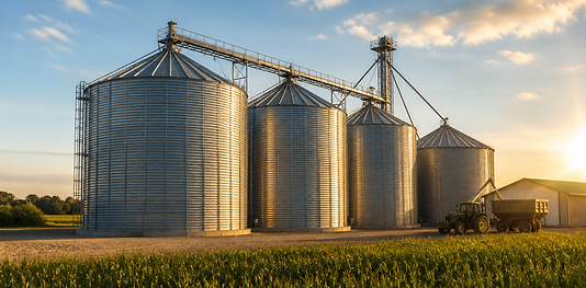
Farmers & Agricultural Operations
Analyze crop conditions and terrain with large-scale aerial coverage designed for Minnesota farmland.

Roofing & Inspection Companies
Access hard-to-reach structures safely with detailed drone-generated models and imagery.
OUR STOCKPILE MEASUREMENT PROCESS
1
2
3
4
5
PLAN
Define site scope and measurement goals.
SCAN
Capture high-resolution aerial data.
PROCESS
Generate 3D models and calculate volumes.
VERIFY
Cross-check data for precision and consistency.
DELIVER
Receive clear volume reports and visuals.
Fast scheduling and clear deliverables.
Full-site coverage in minutes.
Accurate, clean datasets.
Ensure reliable reporting.
Ready for immediate use.
Where Do You Provide Drone Services in Minnesota?
SkyView Drone Services MN proudly provides aerial mapping and 3D modeling services throughout Minnesota.


FREQUENTLY ASK QUESTIONS
Trusted Across Owatonna MN, Rochester MN & Minnesota • FAA Certified & Insured
?
What is aerial mapping used for?
Aerial mapping is commonly used for construction planning, land surveys, agriculture analysis, inspections, roofing documentation, and development projects.
?
How much does drone mapping cost in Minnesota?
Pricing depends on site size, project complexity, turnaround speed, and deliverables requested. SkyView Drone Services MN provides fast custom quotes.
?
What types of files do you deliver?
Deliverables may include orthomosaic maps, 3D models, aerial photos, elevation data, and progress documentation files.
?
Do you provide drone mapping near Rochester MN and Minneapolis MN?
Yes. SkyView Drone Services MN serves Rochester MN, Minneapolis MN, Owatonna MN, and surrounding Minnesota regions.
?
How quickly can service be scheduled?
Same-day and rapid-response scheduling may be available depending on weather and project location.
LET MATERIAL LOSSES
COST YOU THOUSANDS
Get precise stockpile measurements you can trust.
Eliminate errors, reduce waste, and improve profitability across your Minnesota operation.